Surfing Our Engineered Coasts

We like to imagine surfing as pure communion with nature. Hours spent, backs to the land, eyes on the horizon, waiting for the perfect swell to carry us home. It feels elemental. Eternal.

But many of the waves we ride aren’t the wild, untouched gifts we believe them to be. Long before a swell reaches shore, it’s been shaped — sometimes subtly, sometimes profoundly — by human hands. We don’t just surf nature anymore. In many places, we surf what we’ve made.

Whether you’re paddling out at 56th Street or Florianópolis, Hossegor or Haleiwa, Belmar or the Bay of Plenty, you’re likely riding a wave that’s been altered, enhanced, or even entirely created by centuries of engineering. Some of it intentional. Much of it accidental. But all of it consequential. Here’s a look at just a few of these human-created surf spots; stay tuned for more.

Plains, Trains, and Cobblestones

Trestles is sacred ground in California surf lore — raw coastline, pristine watershed, iconic waves. But the surf here was altered more than 135 years ago. Not by surfers. By railroad engineers.

In the 1880s, as the Surf Line railway pushed north from San Diego, a powerful winter storm had shifted river mouths north along their floodplains. The engineers—eager to lay track—froze those rivers in place exactly where they found them.

When they reached San Mateo Creek, they pinned the river mouth where it still sits today: Uppers. The southern end of the floodplain—where Lowers now sits—was effectively cut off. From then on, every major sediment loads went to Uppers. Lowers has been living off hand-me-downs ever since.

Over the next century, that decision was reinforced again and again—by Highway 1, U.S. 101, and eventually the I-5 freeway. And Trestles isn’t the only one. Cardiff Reef, Seaside, Las Pulgas, Ponto, Carlsbad—all of them share this fingerprint. If you’re surfing a wave near a river mouth in Southern California, chances are it’s been fixed, funneled, and fundamentally altered.

And yet, the question lingers: what would these waves look like if the rivers were still free to roam?

Hossegor’s Haunting

Hossegor, France, is one of the crown jewels of beach break surfing—those punchy, perfect peaks that detonate in crystal-clear Atlantic water. But go back a few centuries and you’ll find a different coastline entirely.

For millennia, including the last ice age, when sea levels were lower, the mighty Adour River emptied into the sea between Capbreton and Hossegor. It carried so much energy and sediment from the Pyrenees that it helped carve a massive submarine canyon into the shelf offshore. That canyon still lies out there today, and it plays a critical role in focusing swells.

But in the 1500s, Bayonne—16 miles south—was choking on sand. The river had shifted north and left the city cut off from the sea. Local leaders demanded action. The French Crown answered with one of the most ambitious engineering projects of its day: rerouting and anchoring the Adour’s mouth permanently at Bayonne. It took 16 years.

With the river gone, Hossegor began to change. Dunes grew. Estuaries filled. And the new sediment dynamics gave rise to the sandbars we know and love today. The wave at Hossegor isn’t just natural beauty—it’s coastal legacy, written in rebar and river math.

Mundaka: Lost and Found

In 2003, Mundaka, Spain—home to one of Europe’s premier lefts—was quietly dismantled. Not by storms. Not by climate. By a dredger.

Looking to accommodate shipping traffic from the Murueta harbor, engineers removed over 240,000 cubic yards of sand from the Oka River’s estuary. They deposited it at Laida Beach, upstream. The result? The estuary’s flow shifted and the sediment stopped feeding Mundaka’s perfect sandbar. Within months, the wave was a ghost.

By 2005, the WSL pulled its event. It returned once, briefly, in 2006. But the damage was done. Local businesses, once fueled by surf tourism, floundered. Only then did officials recognize the wave for what it was: vital infrastructure in its own right.

Eventually, thanks to public outcry and careful sediment management, Mundaka began to recover its former glory. But it stands as a case study in what happens when you tamper with a system you don’t fully understand.

New Jersey’s Economic Engine

Meanwhile, across the Atlantic, breaks like Manasquan Inlet in New Jersey owe their very existence to human engineering. From Sandy Hook to Cape May, there are 11 coastal inlets. A hundred years ago all of these inlets were highly dynamic, and would shift regularly with the weather, distributing sand along various parts of Jersey’s shore and barrier islands. But over the past century six have been locked permanently in place, and hardened with jetties on both sides to make for safer passage.

While these moves bolstered recreation and commerce in the area, these structures disrupted the natural sand transport. This led to faster erosion, which led to the installation of more jetties, which cut off even more sand transport. To remedy this issue, New Jersey was one of the first states to acknowledge what others are just now waking up to: if man disrupts a natural system, then man needs to own the role of keeping things in balance with his own efforts.

Nearly 60% of the New Jersey population lives in coastal counties, which is probably why they were one of the first states to make beach nourishment projects routine. Since 1922, New Jersey has spent over $2.6 billion on these types of projects all up and down the state. That might sound like a lot, but it pales in comparison to the tax revenue their beaches generate. The Jersey Shore is its biggest economic driver. In 2023 alone, the state netted more than $5 billion in beach tourism tax revenue. The return on investment has been massive, so it’s an easy call to make. Not surprisingly, New Jersey is home to the largest ongoing Army Corps of Engineer projects ever, and ranks second only to Florida in coastal engineering investment. That said, much of the East Coast is following their lead. And be it Montauk or Masenboro, many of the best waves along the Eastern Seaboard are maintained by human hands, even if it’s not so obvious.

What Do The Wedge and Waikiki Have in Common?

150 years ago, the shores of Waikiki were swampy marshland. What little sand existed was already being mined for local construction projects. But in 1902, when Waikiki’s first hotel opened, its transformation into a tourism hub began, and within two decades, the marshland was drained and rerouted with the Ala Wai canal. Waikiki beach was then filled with imported sand from, of all places, Manhattan Beach, California, and trumpeted as the new tropical paradise in movies and magazines.

Decades later, when scientists discovered that imported sand harmed local marine life, Hawaii began using locally sourced sand. But that supply is now dwindling, as other parts of the islands clamor for the same resource.

The legendary mile-long glide Duke made from Castles to Canoes in 1917 is no longer possible as a result of 100 years of infrastructure projects both on and off shore, but fortunately, Waikiki’s gentle gliders are still there, and the beach boys are teaching new surfers every day.

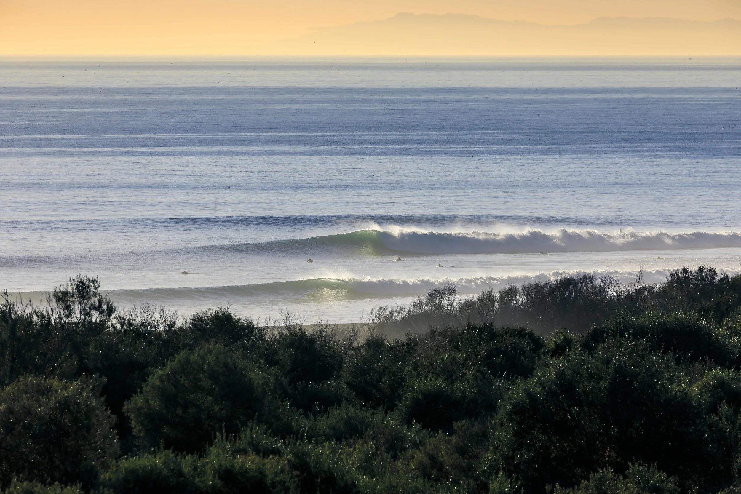
Around the same time Waikiki was being remade, in Newport Beach, harbor hardening created The Wedge, which was the first of what became many man-made waves along the city’s three-mile long peninsula. Over the past 100 years, the former spit of sand has been hardened, secured, and nourished, by human hands. It’s no wonder some surfers in Newport believe The Army Corps of Engineers should have a booth at surf industry trade shows, or maybe even a parade.

When rivers are rerouted, shorelines reshaped, inlets dredged, channels hardened, and roads or railroads built, each leaves a fingerprint on the coast—with real consequences for our beaches and waves. Whether you’re surfing Saquarema or the Superbank, in Chile or Chiba, Bali or the Basque Country, it pays to look under the hood and understand how these systems are functioning—or failing. The more we know about what makes our waves work, and how they came to be, the better our chances of protecting them.

Previous
Previous

Beach Sand: The Most Vital Rare Earth Mineral

Next
Next

Anatomy of a SoCal Sand Crisis